The city of Rotterdam doesn't stand all by itself. It used to, but that was very long ago. Nowadays both Rotterdam and the towns surrounding it have grown into each other, thereby becoming one large urban area. While the surrounding cities (for example Schiedam, Capelle aan den IJssel or Pernis) are formally independent cities, in fact they have become suburbs of Rotterdam. As more and more people came to work in the Rotterdam and Europoort regions, the surrounding towns grew accordingly.
Of course
this happens to many large cities, and during the last few decades the entire region
between Rotterdam, The Hague, Amsterdam and Utrecht became one large urban region. While
this region actually consists of many separate towns and cities, it is often referred to
as the 'Randstad' region (which literally translates as 'Rim City'). And in many aspects
it is one city. People from Rotterdam go shopping in Delft, residents of The Hague go out
in Amsterdam, and those from Utrecht seek recreation in Scheveningen.
The 'Rijnmond' region partially overlaps the Randstad region. However, the term Rijnmond
rather refers to the industrial region surrounding the ports of Rotterdam. Its limits can
be a little vague sometimes. It includes the entire port region, all industrial areas
around it right up to the coast, and the urban regions around Rotterdam.
Let's
take a quick tour around Rotterdam to get an impression of the area surrounding the city.
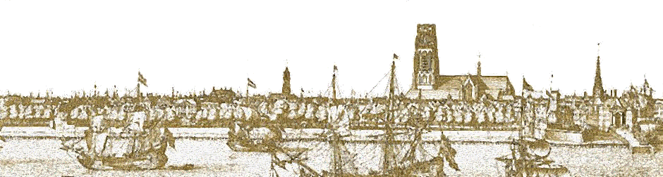
(To see what Rotterdam itself looks like, check the 'Sightseeing Rotterdam' page.)
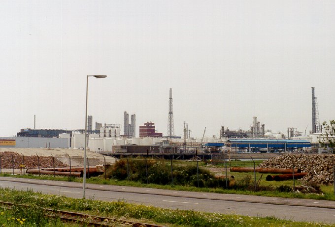 |
Shell Pernis: one of the many petrochemical plants |
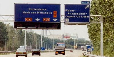
Leaving
Rotterdam on the north side and driving west on the highway A20, we pass Schiedam and then
go through the Benelux tunnel to get on the south side of the river Maas. Just out of the
tunnel we see petrochemical plants on the right. If we continue to drive west, we'll enter
the Europoort region (see the 'Port of Rotterdam' page). Instead, we turn south and drive
along the south side of the city across the highway A15. To our left we can see container
terminals and a number of ports where general goods are transferred. To our right used to
be mostly empty grassland, but now it's rapidly filling up. Most companies here are
involved with warehousing, forwarding and transportation, though we can find almost any
kind of industrial activity in this area.
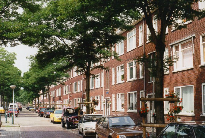 |
Rotterdam Zuid (South): Flakkeesestraat |
We head
back into Rotterdam, this time entering the city from the south side. The southern half of
Rotterdam ('Rotterdam Zuid') was not bombed
out during World War II. There was of course a lot of damage, but no complete destruction
as was the case in the heart of the city. As a result, Rotterdam Zuid has preserved much
of its pre-war character. The post-war parts of Rotterdam have more office buildings and
less houses than they did before 1940, so these areas are more suited for business than
for living. Rotterdam Zuid, however, is still primarily intended to live in it. Many of
the houses were built before the war. Most have been renovated. Others, especially those
dating back to the turn of the century, have fallen into disrepair and are being torn down
and replaced by new ones. And of course the city is always expanding.
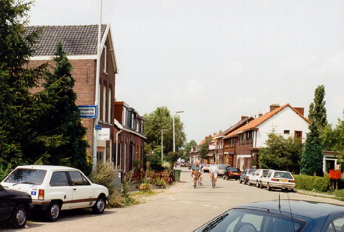 |
IJsselmonde: Hordijk |
A short
hop from Rotterdam Zuid we find IJsselmonde.
The old heart of IJsselmonde still has some of the atmosphere of the small village on the
south bank of the Maas that it used to be. After world war II, when there was a severe
housing shortage, IJsselmonde was rapidly expanded. New houses and apartments were build
as fast as possible. This often led to a uniform and anonymous style. Fortunately the
older parts of IJsselmonde have remained relatively (though not entirely) unaffected, and
some streets have hardly changed at all since the first decades of the 20th century.
 |
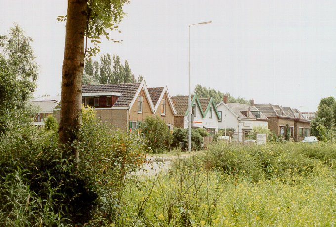
Ridderkerk (Bolnes): Dintelstraat |
We leave
IJsselmonde and continue east on the highway A15. Our next stop is Ridderkerk.
Ridderkerk is also one of the small villages that have expanded tremendously since the
war. Most of the athmosphere of the original heart of the village has been lost during
those post-war decades. Houses in Ridderkerk are much in
demand, because of its location on the south side of Rotterdam and its excellent
accessibility. As a result of the latter especially, industry in and around Ridderkerk has
also seen much expansion. As is usually the case this is all 'light' industry. Heavy
industry is of course only found outside the urban areas.
 |
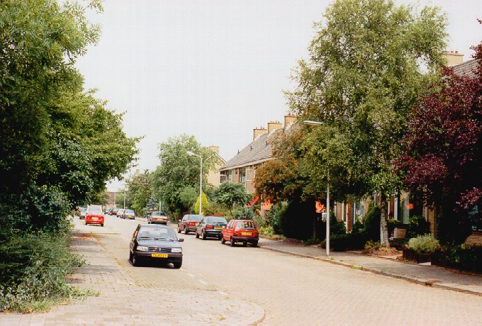
Capelle aan den IJssel: kanaalweg |
Driving
north from Ridderkerk across the highway A16, we cross the Maas again, this time by way of
the Van Brienenoord bridge. (See the 'Sightseeing Rotterdam' page for a picture of the
bridge.) We take the first exit after the bridge. We are now east of Rotterdam and we
drive on to Capelle aan den IJssel (Capelle
for short). Like Ridderkerk (and almost every other town in the region) Capelle also grew
explosively after the war. Older houses in the old heart, and modern buildings, houses and
highrises around it.
![]()
![]()
![]()
![]()